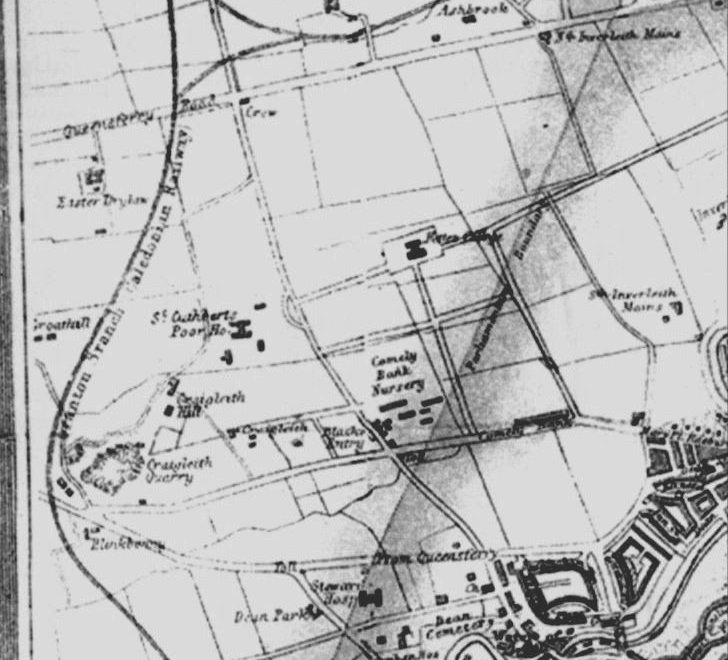
Craigleith Hill House

Map dated 1880 |

Photo taken 1950s |
The area marked Craigleith Hill is thought to be the large house described as
'Craigleith Hill House' by a local resident who lived in Craigleith Hill Row
around the 1940s.
It is shown on some maps as a blob but on others it is shown as a fairly large
house with a double driveway. This large house lay derelict for a number of years
before it was to make way for Craigleith Hill Park. Some residents can remember it
as a ruin and some can remember it had a red roof.
This is confirmed in the John Bell painting of 1860.
It would have stood where the houses 26 to 32 Craigleith Hill Park were built. There may
have been at least three separate access points to the house:
- The waste ground between 71 and 71b Craigleith Hill Crescent
- Through where Craigleith Hill was built. The 'steps' would define this 'right of way'.
- And finally through where 119 Craigleith hill Avenue is now.
In 'The Place Names of Edinburgh' by Stuart Harris he mentions 'Another house west
of Craigleith Hill Crescent and is shown on Knox map as CRAIGLEITH PARK but as
CRAIGLEITH HILL on Ordnance Survey 1852'. Beside Craigleith Park on the map is the
name Constable Esq. 1812 and in 1821 it was Bonar Esq.
These
1828
and 1834 maps
also show a house again marked as Craigleith Park.
See this plan showing Craigleith Hill
House and grounds around 1949.
Maps dated from 1962 no longer show Craigleith Hill House and the area was developed
in 1973 as Craigleith Hill Park.
A lady known to many residents as 'old Mrs Rattray' had a house where
11d Craigleith Hill Park is now situated and when Mrs Rattray moved away her
house was demolished and 11b,11c,and 11d Craigleith Hill Park at the west end
of the waste ground were built in the early 1990s. Another house was built at the
East end of this waste ground and is now 71b Craigleith Hill Crescent.
On the waste ground where (71 and 71b Craigleith Hill Crescent and 11d Craigleith Hill Park were built) is an old iron
gate with stone gate posts set in about 20 yards of wall. It forms part of the boundary between
the three gardens which back onto each other - two in the Crescent and one in the Park.
This may turn out to have some connection with 'Craigleith Hill House'.
Taken from a garden in the Park, this is a photo of a metal gate with only the left stone 'pier' showing.... the other is hidden behind the ivy on the right.
This photograph shows the other side of the gate from a
garden in the Crescent. This time the bottom of the left stone gate post can be seen.